GPS Aided Vision Stitcher – G.A.V.S. (2021 Fall)
The Challenge
Stitching hundreds of high-resolution drone images into a single map is an extremely processor-intensive task. Standard tools often fail when processing more than eight images because they attempt to compare every photo visually, which consumes massive amounts of RAM and crashes standard field laptops.
Our Solution
The team developed G.A.V.S. (GPS Aided Vision Stitcher), which uses a clustering algorithm to group images by their GPS coordinates before the stitching process begins. This innovative approach reduced the peak processing power and memory required by the computer by over 95%.
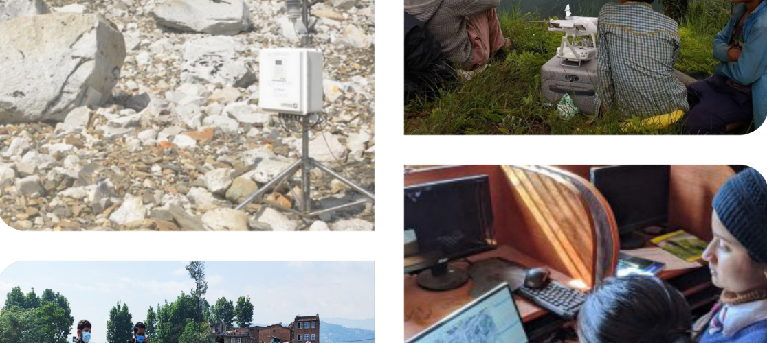
How It Works
RAN uses these maps to analyze soil quality and improve agricultural yields. While traditional vision techniques compare thousands of points across every image, G.A.V.S. only compares photos that are geographically close to each other, allowing for the creation of maps containing over 1,000 images on standard hardware.
The Outcome
This software allows field researchers to generate accurate, large-scale maps on-site without needing expensive supercomputers. It provides a faster and more reliable way to map Nepalese farmlands and support local agriculture.